> ## Documentation Index
> Fetch the complete documentation index at: https://docs.camo.ag/llms.txt
> Use this file to discover all available pages before exploring further.
# October Release Notes
## Create Custom Map Layers
\****Enterprise Customers***
Review the guides in the [Custom Map Layers](/hc/en-us/sections/34369924896279-Custom-Map-Layers) section of the help center
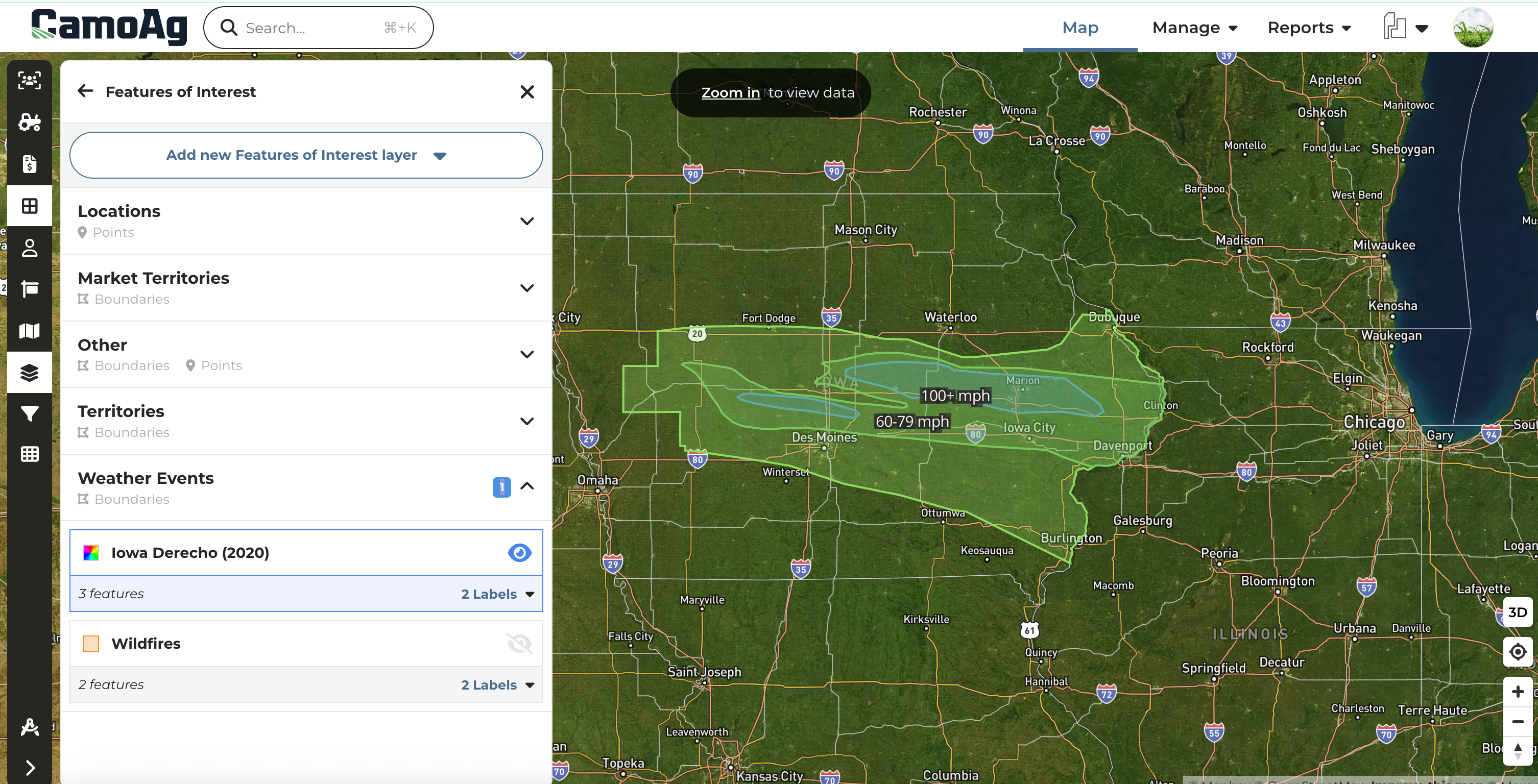
* Create custom map layers to quickly run reports based on market territories, weather events, and more.
* Build layers using hand-drawn shapes, county or township boundaries, addresses, or latitude/longitude coordinates.
* Leverage this powerful feature to run deeper analyses across your organization’s entire footprint.
## Property Size Limitations
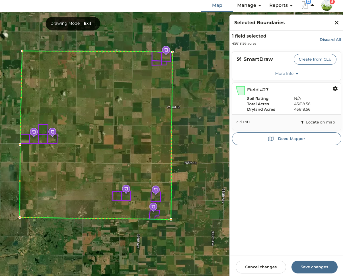
In order to create reports and soil maps for a property, the property size must fall within an area less than 45,000 acres. To put it simply, if you were to draw a square around all the parcels, that square would need to be 45,000 acres or less.
**What does this mean exactly?**
| **Bounding Box** |
| :-------------------------------------------------------------------------------------------------------------------------------------------------------------------------------------------------------------------------------------------------------------------------------------------------------------- |
| If a user needs to generate reports such as a soils map, crop history, and topography, then the total area the parcels fall within should not exceed 45,000 acres. For example, while the parcels that make up this farm is only 1775 acres, the "bounding box" those parcels fall within exceeds 45,000 acres. |
|  |
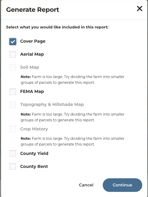
If a property exceeds 45k acres based on the above parameters, a user will see the following messaging if they try to generate a report.
## Network Distinctions
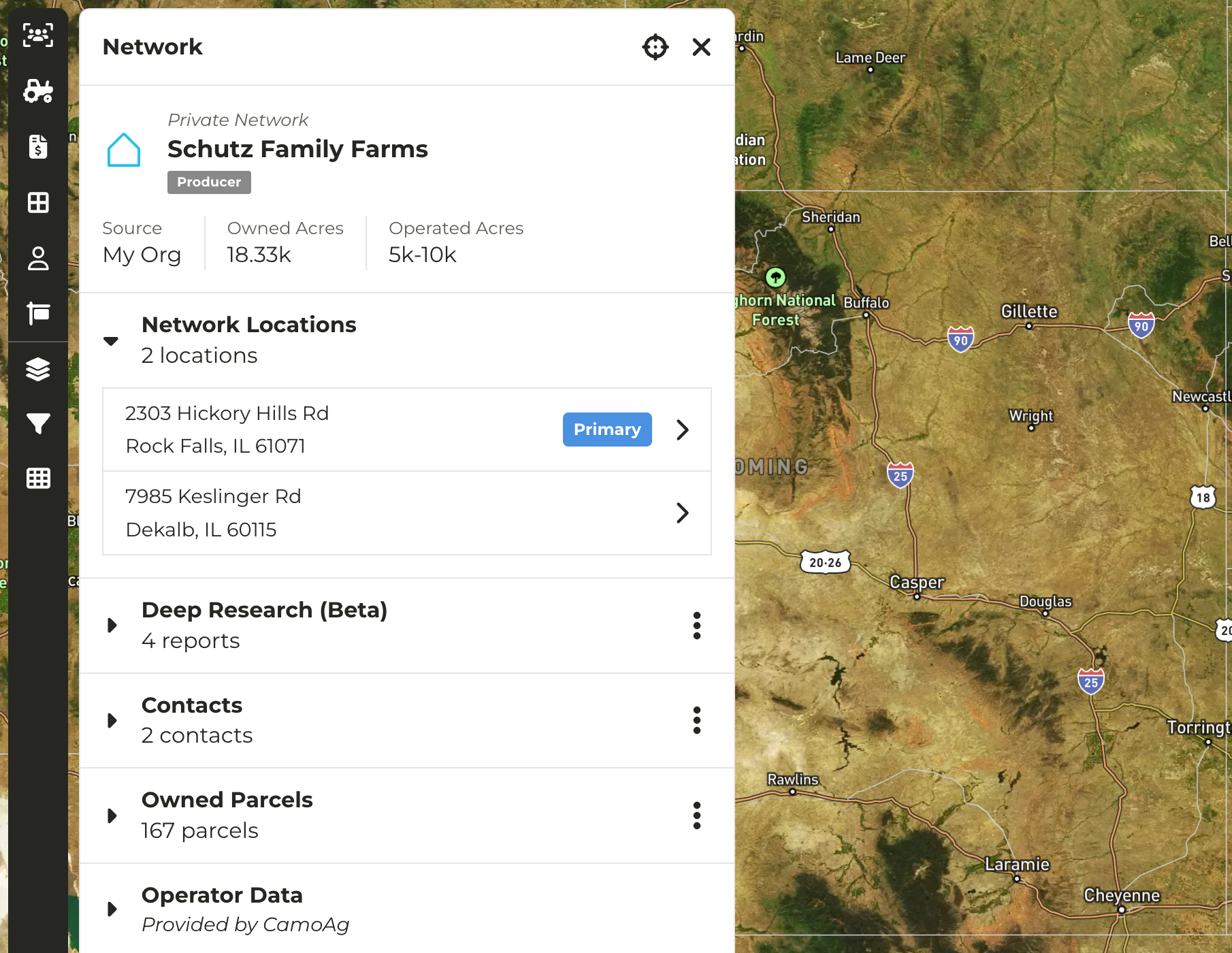
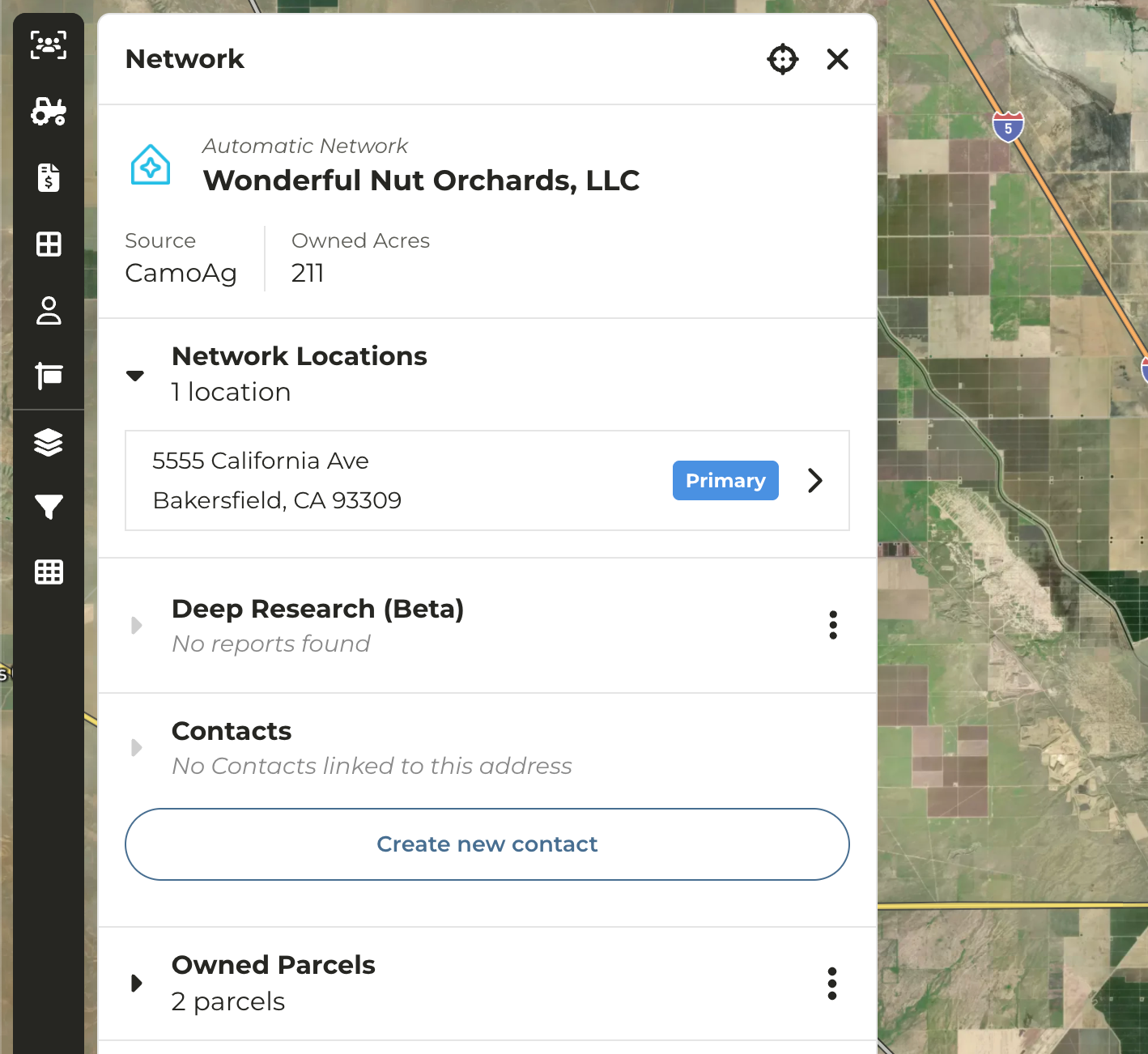
In the platform the concept of public and private networks exist. We've updated the UI to distinguish between **Automatic (Public) and Private networks**
* **Automatic (Public) Networks** - Networks created by CamoAg. These can not be edited as they are used by our customer base.
* **Private Networks** - Networks created by end users through contact creation or ingestion of CRM data. Can be edited by users with Admin permissions only.
## Crop Data Layer Information Refresh
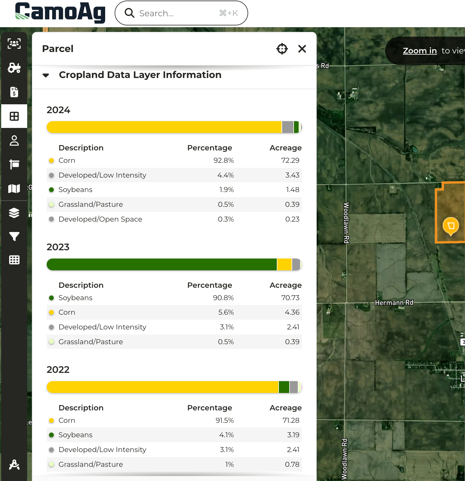
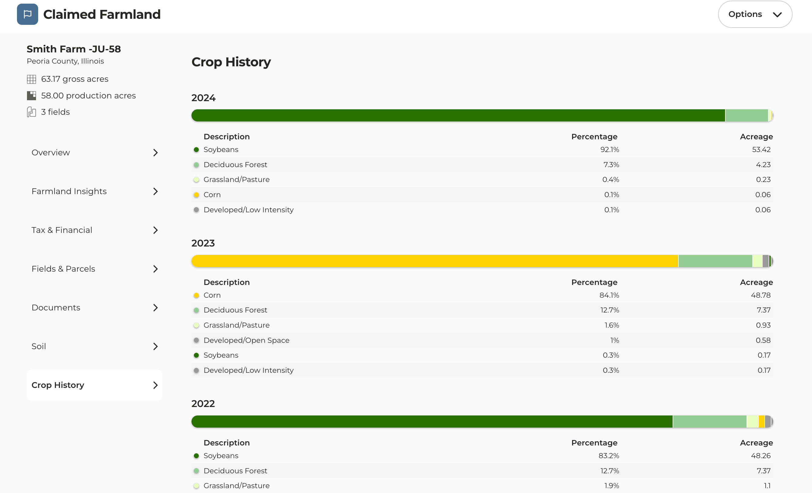
* Crop History data received a face lift replacing the pie charts with friendlier UI
* Parcel pane now displays multiple years of crop history
## Assign Relationship Manager to Contact
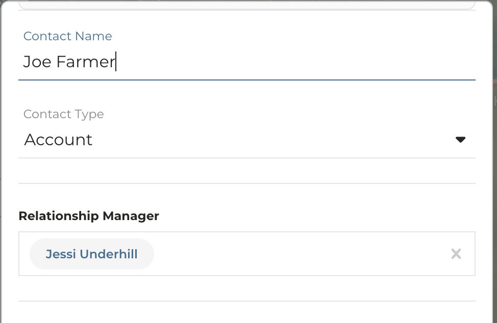
* When creating or editing a contact you have the option to assign a Relationship Manager
* Relationship Manager field will default to the signed in User
* Enables users without a CRM integration to easily create contacts and assign CamoAg users to prospects and customers, simplifying reporting and improving visibility